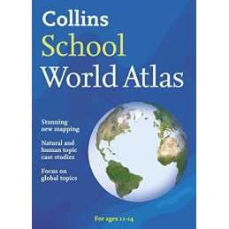
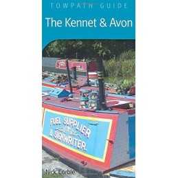
New: A new, unread, unused book in perfect condition with no missing or damaged pages. See the ... Read moreabout the conditionNew: A new, unread, unused book in perfect condition with no missing or damaged pages. See the seller's listing for full details. See all condition definitionsopens in a new window or tab
Explore the exhilarating majesty and mystique of Southeast Alaska with National Geographic's Alaska's Inside Passage Destination Map. The Inside Passage is a meandering waterway formed by a myriad of islands that lie between the North Pacific Ocean and the quieter waters along the coast. At its heart is the Tongass National Forest, the largest national forest in the United States which at a staggering 16.8 million acres contains 19 designated wilderness areas and the Admiralty Island and Misty Fiords National Monuments. This remarkable region of Alaska boasts unparalleled scenery and countless opportunities to experience some of Alaska's most amazing and diverse wildlife as well as its rich native culture and history. Visitors can view the ever-changing landscape of Glacier Bay from passenger ships or wind through Tongass National Forest in a sea kayak. Few roads exist in the region so travel is mainly done by boat or seaplane, both of which allow for a greater opportunity to absorb the icy peaks, spruce-hemlock rain forests, and azure waters. What sets National Geographic maps apart from traditional maps are the rich detail, craftsmanship, and depth of information provided in a colorful and user-friendly format. The front side of Alaska's Inside Passage reveals a striking map of the region from the northern reaches of Glacier Bay National Park and Preserve south to Prince of Wales Island. Information about the islands and other land features, wildlife viewing and safety, the weather, the tides and more is included. The reverse side of the map provides invaluable content for travelers with extensive descriptions of points of interest and information about tours, outfitters, visitor associations, lodging, the geology of the region, and local indiginous cultures. A National Parks chart includes services offered and contact information for each park, and an additional map of the entire state of Alaska provides context for the region. Alaska's Inside Passage is printed in the U. S. A. on a durable synthetic paper, making it waterproof, tear-resistant, and trail tough - capable of going anywhere you do. The map is two-sided, and can be folded to a packable size of 235 x 108 mm, unfolded size is 965 x 660 mm. Net proceeds from the sale of this map go to support the nonprofit mission of the National Geographic Society. Key Features: Chart of Alaska's national parks including services and contact information, Colorful photographs and information about some of the region's diverse wildlife including brown bears, salmon, bald eagles, orcas, sea lions, harbor seals, mountain goats, humpback whales, and puffins, Alaska Marine Highway, state and provincial highways, and sites for scheduled air or seaplane service, National parks and monuments, wildlife refuges, and wilderness areas, Detailed information about tides, weather, water features, wildlife viewing and safety, native cultures, geology, and more, Descriptive content about Tongass National Forest, Klondike Gold Rush National Historical Park, Glacier Bay National Park and Preserve, and Sitka National Historical Park. Popular Places Included on the Map: Glacier Bay National Park and Preserve, Tongass National Forest, Klondike Gold Rush National Historical Park, Sitka National Historical Park, Misty Fjords National Monument Wilderness, Admiralty Island National Monument Kootzoowoo Wilderness, Chichagof Island, Tracy Arm-Fords Terror Wilderness, South Baranof Wilderness, Stikine-LeConte Wilderness, Prince of Wales Island, Revillagigedo Island, Kupreanof Island, Kuiu Island
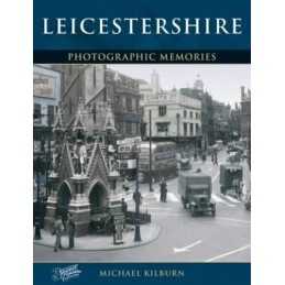
Good condition -A book that has been read, but is in good condition. Minimal damage to the book cover.The majority of pages are undamaged might be with some creasing or tearing, and pencil underlining of text. No writing in the margins, no missing pages.
Very good condition -A book that has been read and does not look new, but is in excellent condition. Don't have obvious damage to the book cover. No missing or damaged pages, no creases or tears, no underlining or highlighting of text, and no writing in the margins.
Good condition -A book that has been read, but is in good condition. Minimal damage to the book cover.The majority of pages are undamaged might be with some creasing or tearing, and pencil underlining of text. No writing in the margins, no missing pages.
Good condition -A book that has been read, but is in good condition. Minimal damage to the book cover.The majority of pages are undamaged might be with some creasing or tearing, and pencil underlining of text. No writing in the margins, no missing pages.
Good condition -A book that has been read, but is in good condition. Minimal damage to the book cover.The majority of pages are undamaged might be with some creasing or tearing, and pencil underlining of text. No writing in the margins, no missing pages.
Good condition -A book that has been read, but is in good condition. Minimal damage to the book cover.The majority of pages are undamaged might be with some creasing or tearing, and pencil underlining of text. No writing in the margins, no missing pages.
Good condition -A book that has been read, but is in good condition. Minimal damage to the book cover.The majority of pages are undamaged might be with some creasing or tearing, and pencil underlining of text. No writing in the margins, no missing pages.
Good condition -A book that has been read, but is in good condition. Minimal damage to the book cover.The majority of pages are undamaged might be with some creasing or tearing, and pencil underlining of text. No writing in the margins, no missing pages.
Good condition -A book that has been read, but is in good condition. Minimal damage to the book cover.The majority of pages are undamaged might be with some creasing or tearing, and pencil underlining of text. No writing in the margins, no missing pages.
Good condition -A book that has been read, but is in good condition. Minimal damage to the book cover.The majority of pages are undamaged might be with some creasing or tearing, and pencil underlining of text. No writing in the margins, no missing pages.
Good condition -A book that has been read, but is in good condition. Minimal damage to the book cover.The majority of pages are undamaged might be with some creasing or tearing, and pencil underlining of text. No writing in the margins, no missing pages.
Good condition -A book that has been read, but is in good condition. Minimal damage to the book cover.The majority of pages are undamaged might be with some creasing or tearing, and pencil underlining of text. No writing in the margins, no missing pages.
Good condition -A book that has been read, but is in good condition. Minimal damage to the book cover.The majority of pages are undamaged might be with some creasing or tearing, and pencil underlining of text. No writing in the margins, no missing pages.
Good condition -A book that has been read, but is in good condition. Minimal damage to the book cover.The majority of pages are undamaged might be with some creasing or tearing, and pencil underlining of text. No writing in the margins, no missing pages.
€17.90
New: A new, unread, unused book in perfect condition with no missing or damaged pages. See the ... Read moreabout the conditionNew: A new, unread, unused book in perfect condition with no missing or damaged pages. See the seller's listing for full details. See all condition definitionsopens in a new window or tab


![Top 10 Chicago [With Map] (DK Eyewitness Top 10 Travel G... by Sotonoff, Roberta](https://pasaulioknygos.lt/2629-home_default/top-10-chicago-with-map-dk-eyewitness-top-10-travel-g-by-sotonoff-roberta.jpg)